 PLN
PLN BRL
BRL CZK
CZK EUR
EUR EUR
EUR EUR
EUR EUR
EUR GBP
GBP RUB
RUB SEK
SEK USD
USD
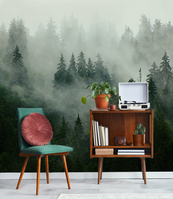


Vinyl wall mural
Vinyl wall murals are printed on a durable material with a smooth, matt texture. The colors of the mural remain vivid for many years thanks to HP Latex ink.
- ✓ Resistant to deformations and stretching
- ✓ Breathable
- ✓ Easy to install
- ✓ Eco-friendly HP Latex ink
Maximum width of one mural panel: 95-105 cm. If the ordered size exceeds the maximum width, the print will consist of multiple evenly cut sheets
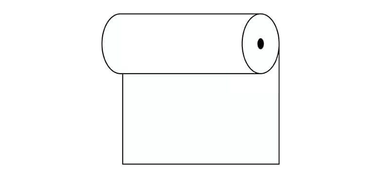
For use on: smooth, even walls
Installation: the glue is only applied on the wall, and the panels are installed edge to edge. This method reduces the risk of damaging your wallpaper and allows for small corrections of its position
Cleaning: with a dry cloth
Finishing: semimatte
Washable vinyl wall mural
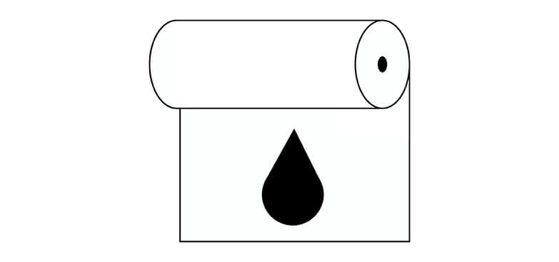
The washable vinyl wall mural is printed on a durable material with a smooth, matt texture, and covered with laminate, which protects the product from humidity and other harmful factors (such as scratches, scrapes, exposure to sun). The modern HP Latex print technology ensures that the colors remain vivid for a long time.
- ✓ Covered with laminate
- ✓ Resistant to humidity, scratches, scrapes, and sun
- ✓ Resistant to deformation and stretching
- ✓ Breathable
- ✓ Easy to install
- ✓ Eco-friendly HP Latex ink
Maximum width of one mural panel: 95-105 cm. If the ordered size exceeds the maximum width, the print will consist of multiple evenly cut sheets
For use on: smooth, even walls, humid interiors (kitchen, bathroom) and spaces exposed to scratches (hallways, children's rooms, hotels, restaurants, conference halls, public buildings, schools, kindergartens, nurseries)
Installation: the glue is only applied on the wall, and the panels are installed edge to edge. This method reduces the risk of damaging your wallpaper during renovation and allows for small corrections of its position
Cleaning: with a wet cloth
Finishing: semimatte

Textured vinyl wall mural
The textured vinyl wall mural is printed on a durable material with the sand texture. The finishing enhances the depth of the print. The HP Latex print technology ensures that the mural will keep its vivid colors for many years.
- ✓ Sand texture
- ✓ Resistant to deformations and stretching
- ✓ Breathable
- ✓ Easy to install
- ✓ Eco-friendly HP Latex ink
Maximum width of one mural panel: 100 cm. If the ordered size exceeds the maximum width, the print will consist of multiple evenly cut sheets
For use on: smooth, even walls. The mural can be successfully used in private apartments, restaurants, schools, as well as offices
Installation: the glue is only applied on the wall, and the panels are installed edge to edge. This method reduces the risk of damaging your wallpaper and allows for small corrections of its position
Cleaning: with a dry cloth
Finishing: semimatte with sand texture

Washable vinyl structured wall mural
The vinyl wall mural is printed on a durable material with the sand texture. The finishing enhances the depth of the print. The HP Latex print technology ensures that the mural will keep its vivid colors for many years.
- ✓ Covered with laminate
- ✓ Sand texture
- ✓ Resistant to humidity, scratches, scrapes, and sun
- ✓ Resistant to deformation and stretching
- ✓ Breathable
- ✓ Easy to install
- ✓ Eco-friendly HP Latex ink
Maximum width of one mural panel: 100 cm. If the ordered size exceeds the maximum width, the print will consist of multiple evenly cut sheets
For use on: smooth, even walls. Humid interiors (kitchen, bathroom) and spaces exposed to scratches (hallways, children's rooms, hotels, restaurants, conference halls, public buildings, schools, kindergartens, nurseries) Installation
Cleaning: with a wet cloth
Finishing: semimatte with sand texture
Self-adhesive wall mural
The universal character of the mural makes it a perfect option for many types of interiors and surfaces. Self-adhesive murals look great on walls, but also on closets, glass, furniture, and other smooth surfaces. The mural will keep its vivid colors for many years thanks to the HP Latex print technology.
- ✓ No extra glue required
- ✓ Resistant to deformations and stretching
- ✓ Breathable
- ✓ Eco-friendly HP Latex ink
Maximum width of one mural panel: 133 cm. If the ordered size exceeds the maximum width of the material, the print will consist of multiple evenly cut sheets
For use on: smooth surfaces, universal in use
Installation: edge to edge
Cleaning: with a wet cloth
Finishing: semimatte
